Table of Contents
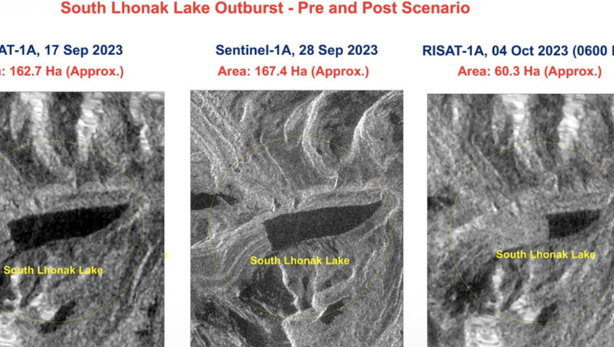
The South Lhonak lake suddenly burst in Sikkim, and the National Remote Sensing Centre, one of the ISRO facilities, did a satellite-based analysis of the situation that displayed temporal satellite photos of the region both before and after the incident.
105 hectares of land were drained between the photographs obtained on September 28, 2023, and October 4, 2023, according to an ISRO statement made public on Wednesday. This was due to the lake having burst, the statement said.
An image shot at 6 AM on Wednesday morning shows the lake decreased by more than half, with only an estimated 60.3 hectares of water in it. This was after the cloudburst and flash flood caused havoc in the state, destroying significant portions of a hydroelectric project and leaving 49 people unaccounted for.

Heavy rains caused a glacial lake to burst, resulting in 14 deaths and 102 missing
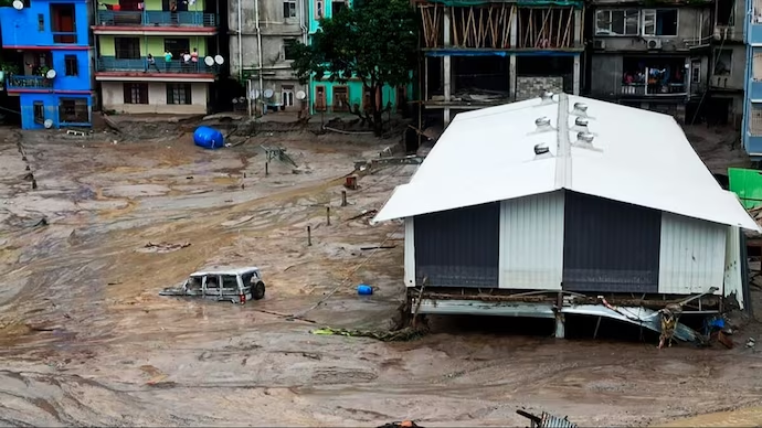
Yesterday , a cloud burst over Lhonak Lake in North Sikkim caused a flash flood in the Teesta River in the Lachen Valley. Following the cloudburst in the small, hilly state, at least 14 people perished and 102 went missing. The release of water from the Chungthang dam exacerbated the flood that began in Sikkim at 1:30 am.
flooding has occurred in a number of Teesta basin towns, including Dikchu, Singtam, and Rangpo, as a result of the river’s increase. More than 3,000 visitors are reportedly stuck in various locations throughout Sikkim, while 166 individuals have reportedly been saved to date, including the army soldier.
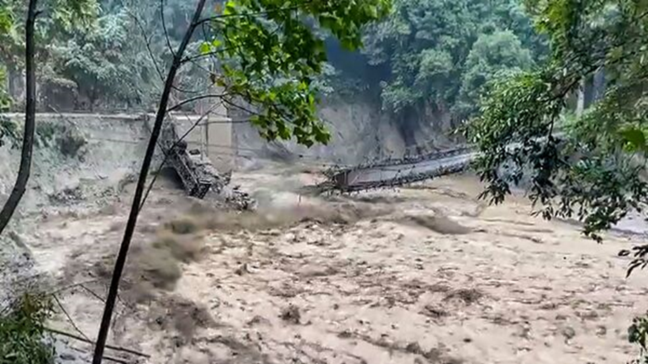
Teesta River Dam Debris Washes Away After Cloudburst

The lake had collapsed according to an ISRO statement made public on Wednesday, and between the photographs obtained on September 28, 2023, and October 4, 2023, 105 hectares of land had been drained. This incident might have caused a swift downstream flood.
Over Lhonak Lake in the state’s northern portion, there was a cloudburst.
The Teesta river was running at the danger mark on Wednesday as a result of a major flash flood that was caused by a cloudburst in Sikkim. The largest hydropower facility in Sikkim, the Teesta Dam at Chungthang, was also partially destroyed by the excessive river floods.
As the swelling Teesta water continued to flood over the dam in North Sikkin’s Mangan region, images from the scene reveal significant sections of its wall missing. The state’s northern Lhonak Lake saw a cloudburst, which caused the river that flows through Sikkim and West Bengal to overflow.
According to the Indian Army, the water level downstream suddenly rose by 15-20 feet as a result of the Chungthang dam’s water flow. Parts of the National highway (NH-10) at Melli, a border town between Sikkim and West Bengal, were also washed away by the flowing river water.
Sikkim’s connectivity, notably to its capital Gangtok, has also been compromised. According to a report from the Sikkim police, roads in the districts of Gangtok, Pakyong, Mangan, Namchi, Gyalshing, and Soreng have been blocked. Additionally, obstructed are stretches of NH-10 close to Siliguri.
Did devastation in Sikkim caused by the Nepal earthquake
Scientists are trying to determine if Tuesday’s powerful earthquake that shook Nepal and the surrounding area was to blame for the south Lhonak lake outburst that resulted in a flash flood in the Sikkim Teesta river basin.
The main hydropower facility in the state, the Chungthang dam, was breached as a result of the lake outburst. The state government is the largest shareholder in the 1,200 MW Teesta Stage III Hydro Electric Project, which includes this dam.
Residents of North Sikkim’s Chungthang town and Singtam district have been evacuated from the low-lying areas.


