


The India Meteorological Department (IMD) issued a yellow alert saying that cyclone Hamoon may intensify in the next 12 hours.
Table of Contents
The IMD said that the depression that has formed over the Bay of Bengal may intensify and develop into a cyclone storm ‘Hamoon’ by Tuesday, October 24. The cyclone has been named ‘Hamoon’. IMD has issued a yellow alert for some states, saying that Cyclone Hamoon in the Bay of Bengal may intensify in the coming 12 hours.
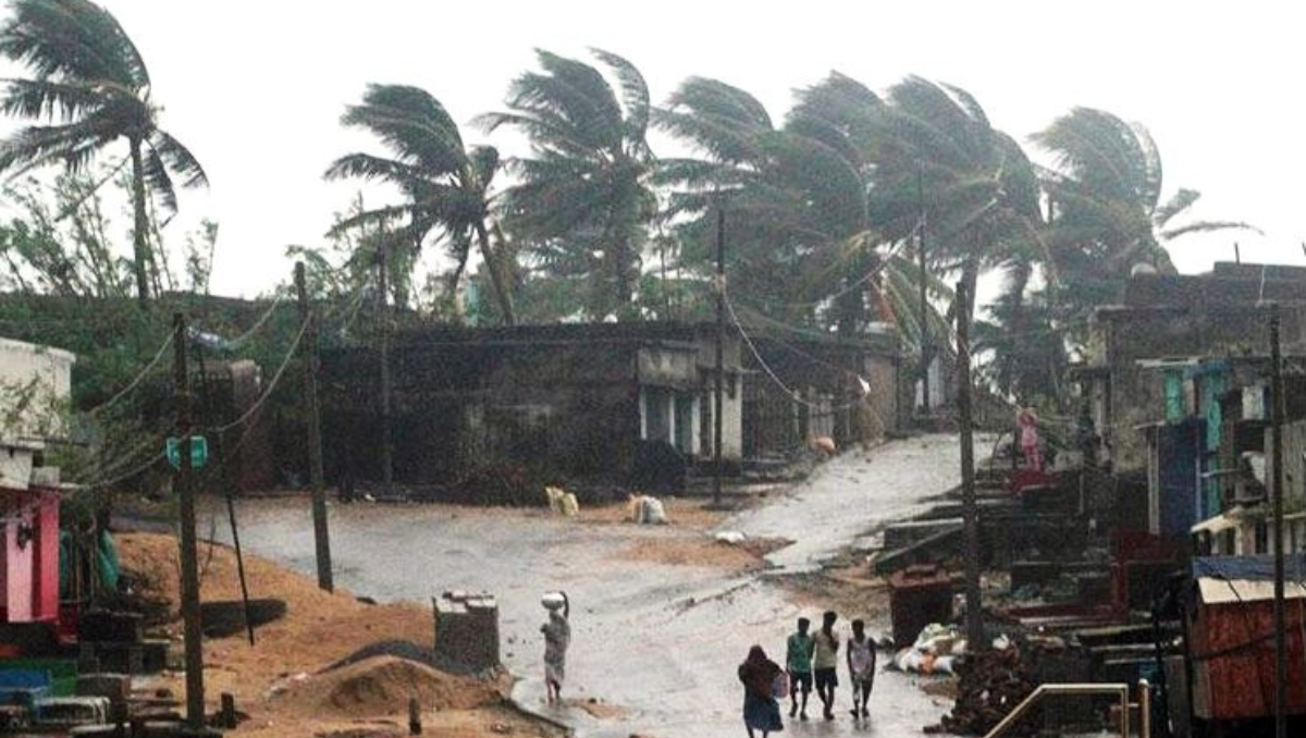
Currently, India braces for twin storms: Cyclone Tej in the Arabian Sea and Cyclone Hamoon in the Bay of Bengal. Due to cyclone Hamoon, light to moderate rainfall is likely expected for the next two days in the coastal areas of Odisha and many other nearby places. Cyclone Tej further strengthened into a severe cyclonic storm and moved its course to the Middle East.
Cyclone Hamoon
According to the IMD, cyclone Hamoon moved northeastwards on October 22 and is currently situated in the West-Central Bay of Bengal. The storm lies centered around 400 km from Odisha’s Paradip and 550 km south-southwest of Digha in West Bengal.

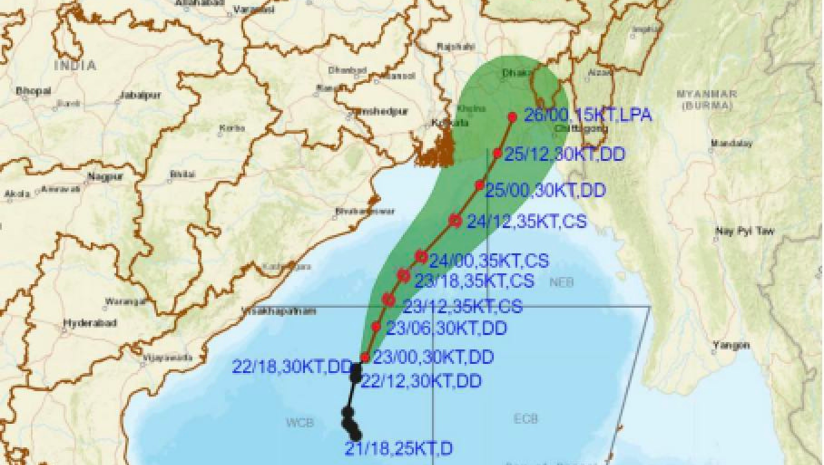
Given the progress and the storm’s speed, it is likely expected to move further north-northeastward and cross the Bangladesh coast between Khepupara and Chittagong by around October 25 (Wednesday) evening. The name ‘Hamoon’ was given by Iran.
The above image was uploaded by the IMD on their official site, showing the cyclone Hamoon moving towards Bangladesh and other parts of India from the Bay of Bengal. It is expected that the deep depression in the Arabian Sea will turn into severe cyclone storm.
Yellow Alert
The IMD had forecast light to moderate showers with heavy rains in the states of Meghalaya, Nagaland, south Assam, Manipur, Tripura, and Mizoram until Friday, October 26. The IMD also issued a yellow warning for major West Bengal districts, including Howrah and Hoogly.
Odisha government advisory
After the warning from IMD, the Odisha government asked all the district collectors to be prepared amidst the cyclone and directed the administration to evacuate people from low-lying areas. The authorities under a warning, were asked to keep machinery ready to tackle any situation. Here’s what a senior scientist of IMD Bhubaneshwar said to ANI.
Cyclone Hamoon will bring rainfall and ruin Navratri!
As India is immersed and busy in the celebration of the nine-day-long Navratri festival, West Bengal is at high risk of receiving rainfall due to cyclone Hamoon. Throughout Hamoon’s course, the cyclone is all set to bring rainfall to West Bengal and Odisha, ruining Navratri.
According to the IMD forecast, the coastal districts in Odisha and West Bengal are likely to have moderate rainfall on October 23 and 24. With them, the northeastern states of India will also get some heavy rainfall in the next two days.

There will be light to moderate rainfall with isolated heavy showers in Nagaland, Manipur, Mizoram, Tripura, south Assam, and Meghalaya until Thursday, October 26. IMD issued a yellow alert in major districts of West Bengal, including Howrah and Hoogly, on Tuesday.
With cyclone Hamoon, the weather will be very much affected in West Bengal, Odisha, and some nearby areas. IMD issued a warning to fishermen not to venture into the sea until October 25 due to strong winds and ‘rough’ sea conditions.
As there are high chances of rain and bad weather due to Hamoon, Navratri celebrations may be intervened. The rainfall is likely to coincide with Navratri celebrations. In view of the cyclone and weather conditions, the festival organizers are preparing for rainfall.


